Tour Zu Fuß Brentino Belluno - Belluno Veronese - Passo del Cerbiolo - Photo

Belluno Veronese - Passo del Cerbiolo

Tous les sentiers balisés d’Europe PRO

© OpenStreetMap contributors
Länge
Länge
5,6 km
Maximale Höhe
Maximale Höhe
1399 m
Positive Höhendifferenz
1235 m
Km-Effort
Km-Effort  
18,1 km
Min. Höhe
Min. Höhe
152 m
Negative Höhendifferenz
25 m
Boucle
Boucle
Nein
Kennzeichnung
Kennzeichnung
Erstellungsdatum :
2022-02-15 06:43:56.832
Letzte Änderung :
2022-03-01 05:57:21.715

(0 Nachricht)

Zu Fuß
Zu Fuß
4h06
Schwierigkeit : Einfach

Scannen Sie diesen QR-Code, um die Tour in der SityTrail-Anwendung zu öffnen

Kostenlosegpshiking-Anwendung

Logo SityTrail SityTrail

IGN / Geografische Institute

SityTrail aus dem App Store herunterladen SityTrail von Google Play herunterladen

Logo SityTrail SityTrail World

Die Welt öffnet sich für Sie

SityTrail aus dem App Store herunterladen SityTrail von Google Play herunterladen SityTrail auf Huawei AppGallery herunterladen

Über SityTrail

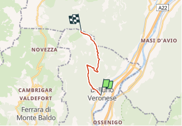
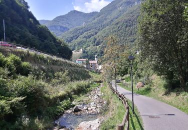
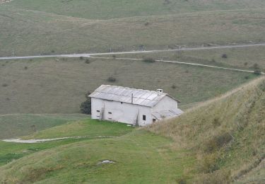
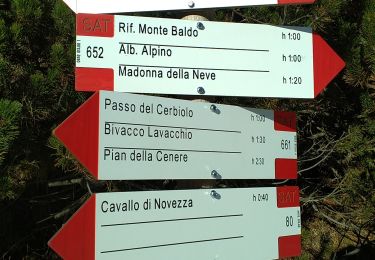
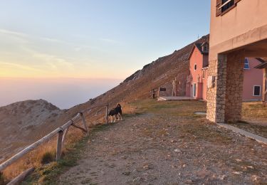
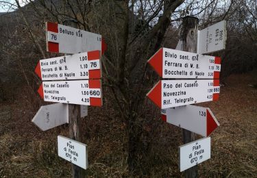
Tour Zu Fuß von 5,6 km verfügbar auf Venetien, Verona, Brentino Belluno. Diese Tour wird von SityTrail - itinéraires balisés pédestres vorgeschlagen.

Beschreibung

Trail created by Club Alpino Italiano Sezione di San Pietro in Cariano.

relation mantained by Club Alpino Italiano Sezione di San Pietro in Cariano, before making changes contact the CAI structure

Symbol: 678 on white red flag


Website: http://www.caivalpolicella.it

Foto-Galerie

Ort

Land:
Italy
Region :
Venetien
Abteilung/Provinz :
Verona
Kommune :
Brentino Belluno
Standort:
Unknown
Gehen Sie:(UTM)
647823 ; 5060863 (32T) N.

Touren in der Umgebung

Tour Zu Fuß Dolcè - Dorsale Media della Lessinia - Photo
Zu Fuß
PRO

Zu Fuß

Sehr schwierig
Dolcè, Venetien, Verona, Italy
39 km | 71 km-effort
16h 1min
Nein
Tour Zu Fuß Dolcè - Peri - Genderli - Photo
Zu Fuß
PRO

Zu Fuß

Sehr schwierig
Dolcè, Venetien, Verona, Italy
27 km | 50 km-effort
11h 23min
Nein
Tour Zu Fuß Sant'Anna d'Alfaedo - Dorsale Alta della Lessinia - 4° tratto - Sentiero di Rocca Pia - Photo
Zu Fuß
PRO

Zu Fuß

Einfach
Sant'Anna d'Alfaedo, Venetien, Verona, Italy
8,1 km | 13,3 km-effort
3h 0min
Nein
Tour Zu Fuß Dolcè - Dorsale Alta della Lessinia - Photo
Zu Fuß
PRO

Zu Fuß

Sehr schwierig
Dolcè, Venetien, Verona, Italy
40 km | 66 km-effort
15h 3min
Nein
Tour Zu Fuß Sant'Anna d'Alfaedo - Dorsale Alta della Lessinia sezione Passo Fittanze - Tommasi - Photo
Zu Fuß
PRO

Zu Fuß

Einfach
Sant'Anna d'Alfaedo, Venetien, Verona, Italy
5,8 km | 10,5 km-effort
2h 22min
Nein
Tour Zu Fuß Avio - Sentiero Bovi - Photo
Zu Fuß
PRO

Zu Fuß

Einfach
Avio, Trentino-Südtirol, Provincia di Trento, Italy
3,4 km | 9,2 km-effort
2h 5min
Nein
Tour Zu Fuß Ferrara di Monte Baldo - Sentiero Agostino Goiran - Photo
Zu Fuß
PRO

Zu Fuß

Einfach
Ferrara di Monte Baldo, Venetien, Verona, Italy
4,6 km | 13,7 km-effort
3h 6min
Nein
Tour Zu Fuß Ferrara di Monte Baldo - Belluno Veronese - Ferrara di Monte Baldo - Photo
Zu Fuß
PRO

Zu Fuß

Einfach
Ferrara di Monte Baldo, Venetien, Verona, Italy
7 km | 11,6 km-effort
2h 38min
Nein
Tour Zu Fuß Sant'Anna d'Alfaedo - Tommasi - Corno d'Aquilio - Photo
Zu Fuß
PRO

Zu Fuß

Einfach
Sant'Anna d'Alfaedo, Venetien, Verona, Italy
5,3 km | 11 km-effort
2h 30min
Nein


Schließen
Meine Abonnements